Timelapse
See the connection between fire and water.
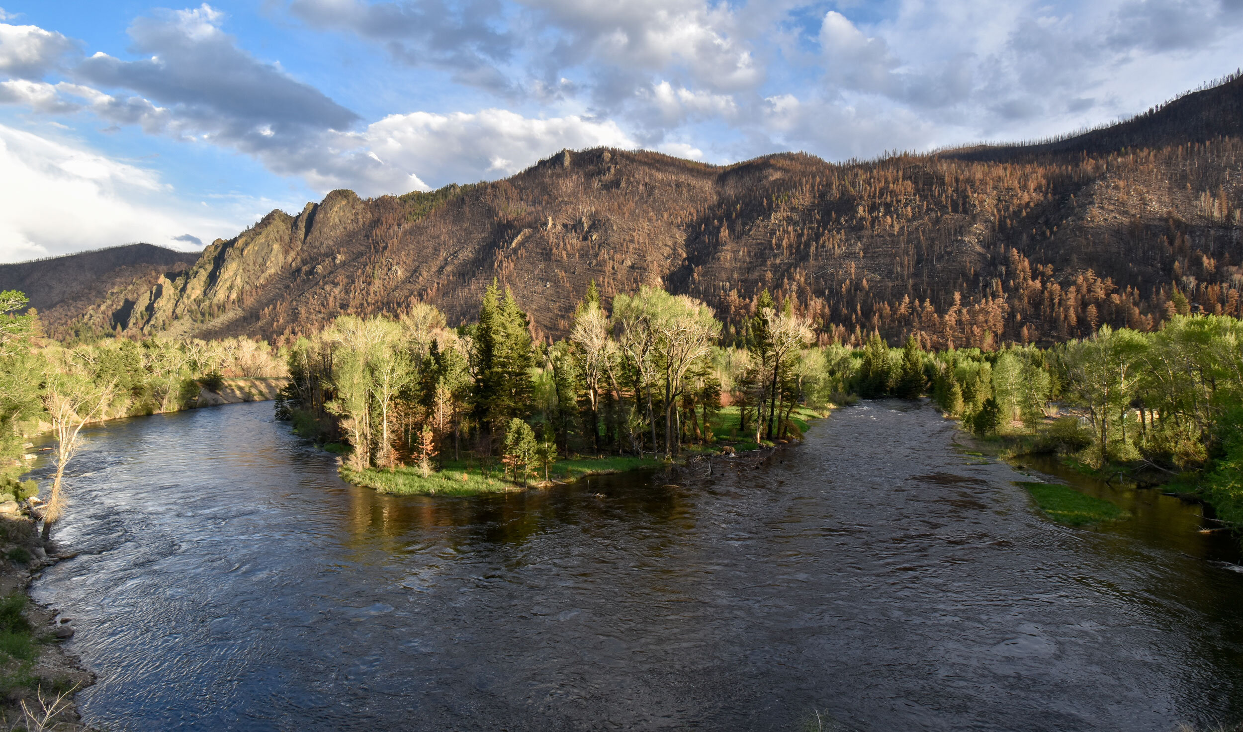
There is a direct relationship between forest health and water quality. In the wake of large and severe wildfires, downstream water quality often is at risk from erosion and debris. Without live plant roots to hold soil in place, summer rains are able to wash the exposed soil into the streams and rivers below. This increases water turbidity and often causes algal blooms that are serious threats to fish and public drinking water.
Starting May 22, 2021, a long-term timelapse camera began to photograph the Poudre River and severely burnt slopes behind it every daylight hour. With these images, Platte Basin Timelapse and Fireforest will create timelapse videos like the one below that show the fire’s impact on the Poudre River over the next five years. The timelapse seeks to show Coloradans the risks our water faces without forest restoration. To protect our water, we must restore our forests.
July 31, 2023 Storm
Three years after the Cameron Peak Fire, the Cache la Poudre River became extremely turbid after a severe storm washed ash and sediment into the river. Watch as the river fills with ash and sediment and rapidly rises after the storm.
The Cache la Poudre River during the July 31, 2023, storm. Video: Evan Barrientos/Fireforest
May 2021 Runoff
The Cameron Peak Fire began impacting the Cache la Poudre River the spring after the fire, when snowmelt washed sediment and ash from the fire into the river.

Sedmient and ash in the Cache la Poudre River between May 22–31, 2021. Video: Evan Barrientos/Fireforest/Platte Basin Timelapse
Black Hollow Flood
On the evening of July 20, 2021, strong rains fell over the Cameron Peak Fire scar. In severely burnt areas, the water carried sediment and debris into the Cache la Poudre River, causing a spike in turbidity so high that fish suffocated. The Black Hollow Drainage funneled some of this water and debris, causing a flash flood that killed at least three people. During this event, the Fireforest timelapse captured the Poudre River as it ran black with sediment.

Extreme sediment levels between July 19–August 4, 2021. Video: Evan Barrientos/Fireforest
Summer Rains
The Black Hollow Flood was the most damaging water event of 2021, but it wasn’t the worst water quality day. That came ten days later on July 30. Heavy rains washed so much sediment, ash, and debris into the Poudre River that from a distance the water looked like mud for days. Watch as the river runs black in this timelapse from July 30–August 6, 2021.

Sediment, ash, and debris fill the Cache la Poudre River after heavy rains between July 30–August 6, 2021. Video: Evan Barrientos/Fireforest
Low vs. High Turbidity
A brief runoff event on August 17, 2021, lets you compare the Cache la Poudre River at low and high turbidity. Turbidity is the measure of how clouded water is by solid particles like dirt and ash.

Cache la Poudre River on August 16–17, 2021. Video: Evan Barrientos/Fireforest
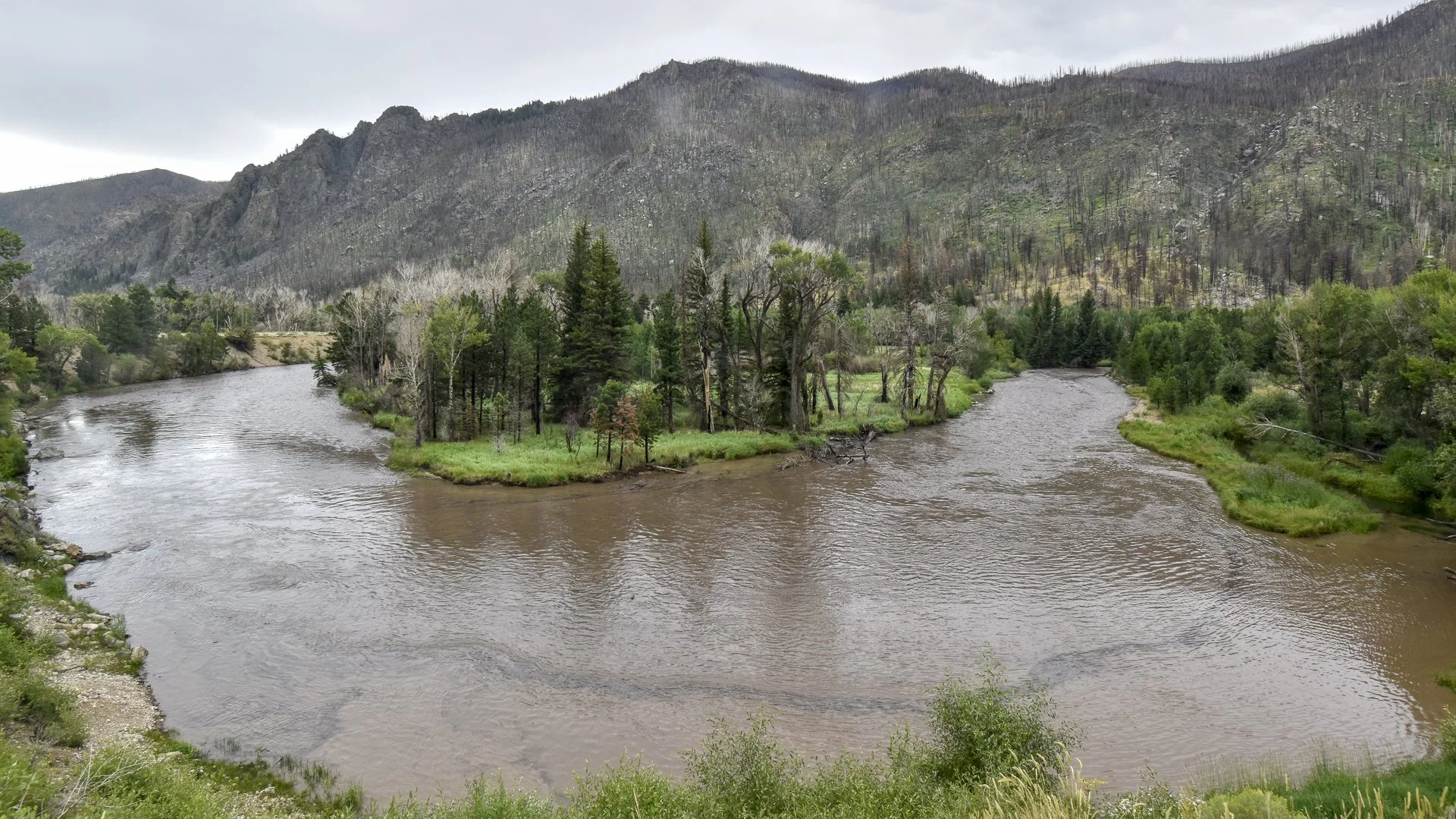
The intense turbidity continued in the spring of 2022. The extreme amount of sediment and ash stored on the bottom and banks of the Poudre River in 2021 was resuspended in the water as the river rose and its flow intensified.
The Cache la Poudre River before (left) and during (right) spring 2022 runoff. Photos: Evan Barrientos/Fireforest
Explore Fireforest
-

About
Learn about the project’s objectives and the people behind it.
-

Photo Essay
See the diversity of fire’s effects on the forest.
-

Photo Monitoring
See how different types of forest respond to the Cameron Peak Fire in high detail.